If the request to build the Canso Causeway were made today, it would be denied.
“If you look back in the paperwork and the history of the Causeway, it was originally supposed to be a bridge because it never makes sense to block the ocean,” said Kathleen Martin, executive director of the Canadian Sea Turtle Network (CSTN).
The initial bridge plan cost $13.5 million. As that plan was explored, the issues of the water depth, strong currents, tides, and ice buildup became a concern to another group of engineers studying the project. In an online document entitled “Road to the Isles,” it said, “They argued the fourteen-foot-high pillars were too weak to withstand the extreme pressure of shifting ice and high winds during winter in the strait. The debates between engineers continued until finally the Board of Engineers appointed for the job agreed that the pillars may not be safe enough.” The causeway plan came in at $23 million dollars.
No dollar figures were located on how much a bridge that could withstand the conditions would cost, but a Master’s thesis by Meghan Beaton, a student at Saint Mary’s University in 2001, cited a document in which Premier Angus L. Macdonald argued that a causeway could be built for less than a bridge.
The approval to build the causeway was given in 1951, and construction began in 1952. It took 10 million tons of rock from Porcupine Mountain to be dumped into the Strait of Canso to permanently connect Cape Breton to mainland Nova Scotia on December 10, 1954. On August 13, 1955, the Canso Causeway was officially opened.
The Canso Causeway was an engineering marvel. It is 1,385 metres long, and at its deepest point, the water is 65 metres deep. At its base, the causeway is 244 metres wide, and approximately 40 metres wide at the top. Ever since it was built, the south side has been ice-free.
The opening of the causeway initially caused hundreds of job losses and out-migration as the ferry system closed down. But the ice-free status of the harbour for Port Hawkesbury, Point Tupper, and Mulgrave led to industries moving in, including the pulp and paper mill. It is one of the largest ice-free ports in the world, and the Strait of Canso Superport has become a major economic player in the region.
But long before we knew about leatherback sea turtles in our waters, we knew about the fish. The completion of the causeway disrupted a number of fisheries. Old fishermen have told stories of how the cod run changed or how halibut stocks on the north side of the causeway moved once it was built.
Dr. Mike Dadswell, a professor at Acadia University, was working for DFO in the 1970s and was called upon to study why the lobster fishery in the Chedabucto Bay collapsed 15 years after the Causeway cut off the Gulf of St. Lawrence from the Atlantic Ocean.
He theorized the recruitment cell was broken. That is, lobster larvae came from St. Georges Bay in the Gulf and drifted with the current south into Chedabucto Bay. The causeway stopped that larval transport, and so the lobster population in Chedabucto Bay was no longer being replenished. His theory was not well received by DFO and their other lobster scientists, who said over-fishing was the cause of the collapse. Though indeed over-fishing was to blame, it was only in that the lobster fishers were fishing a population that was not being replenished, and they didn’t know it at the time.
Years later, Dadswell’s hypothesis was accepted, as he said, “They started copying my stuff and publishing papers on it.”
In the 1950s, it didn’t occur to anyone that the Causeway would disrupt anything. “Back then,” he said, “they didn't have environmental impact studies. I mean, they did all kinds of things in the 50s they shouldn’t have, like putting all those causeways in at PEI that all got torn out later on. And the one over in Moncton; they tore that out. That was a big mistake. It was cheap. You don't have to build a bridge because building a causeway is much cheaper than building a bridge.”
The Causeway altered more than fisheries. Dadswell hypothesizes that the causeway shut down the area as a productivity pump. “Places like the Canso Causeway and the Minus Passage are very productive because of the huge flow [of water] they have. There is this tremendous upwelling that doesn’t happen out in the ocean because of the thermocline.”
A thermocline is the transition layer of water between the warmer surface waters and the cooler deep waters.
“The water above the thermocline loses nutrients as algae, diatoms, and such eat it up,” said Dadswell. “Productivity drops after the end of June. But in the Minus Passage, you get a tremendous amount of upwelling, just like you would’ve gotten in Strait of Canso, and that wouldn’t happen because you’d be continually pumping cool nutrient-rich water to the surface.”
He suggests that as the causeway stopped the flow of water, the upwelling stopped and dropped the productivity of the region. He never had the opportunity to flesh out his ideas, but did mention it briefly in an unpublished technical paper from 2017, as he described the loss of the pollack, herring, tuna, and mackerel fisheries after the Causeway was built.
Dr. Bruce Hatcher is the University Chair in Marine Ecosystem Research at Cape Breton University and an adjunct professor at Dalhousie University. He, too, spoke about the value of the connection between bodies of water. “The Strait of Canso has been an important separation between Cape Breton and the mainland for millennia. Organisms have adapted to swimming there at will,” he said. “The causeway put an end to that, and organisms have not responded adequately to it.”
He noted the Atlantic saury, which tries to run through the Strait every fall. “Atlantic saury have a short and brutish lifespan of a couple of years. And yet, more than half a century after their migration pathway was shut off, which would be, at least 25 generations, their instincts are still telling them to swim south into Saint George’s Bay on their way to the Atlantic. And they run into the wall, and they don't know what to do, and then it creates this incredible feeding frenzy of both marine predators and aerial predators, birds of all kinds. The chaos at the causeway in October typically brings both bird and marine photographers from all over the world. It’s a really good example of how the relatively rapid act over 50 plus years ago to close that [passage] has repercussions that will echo as long as it takes a species to finally get deprogrammed from turning right and heading into St. George's Bay, rather than keep going left until they can get around Meat Cove.”
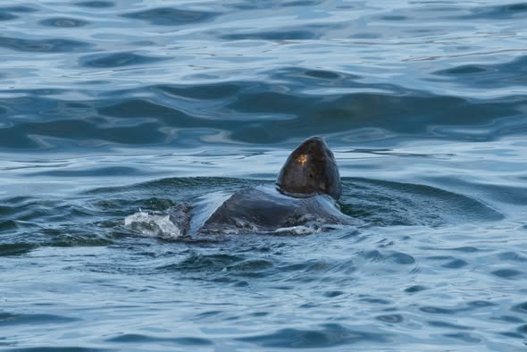
And for a leatherback sea turtle, whose lifespan he said could be 100 years, he said, “They are a good example of the kind of thing that happens when you take something that is of evolutionary and historical significance, that has been a feature of the marine seascape for long enough that species adapt their innate behaviour to the existence of that opening. Something is drawing them in that direction, and then they hit this wall. But the messaging to them from their deep memory, their instinct, is that, ‘Yes, this is the direction.’ They go south at this time of year because it’s getting cold. And as they move into St. George's Bay, they get the messaging that they are moving in the right direction. And then they hit the wall, and of course, they don't know what to do. They don't know how to phone the guy at the locks.”
Darren Porter, as previously reported, is the fisherman from Windsor, Nova Scotia, who secured the Access to Information and Privacy file on what happened to Dina. He is hopeful that her death will not be in vain. “The turtle will save everything else,” he said. “This is about sharks, whales, little fishes, and big fishes. This is huge for tuna, lobster, and striped bass. It’s also about nutrient transfer and water quality.”
What Dadswell and Porter would like to see happen is for a passage to be made for organisms to get through. “It would only need to be 30 metres or less wide by maybe 20 metres deep,” said Dadswell. “It would still keep most of the ice out of the south side of the causeway.”
Hatcher recognized the concern some might have that doing so might cause more problems than it fixes and said, “Now that we have the technology and models to make predictions about opening it up, what would the effect of that be? It's had more than half a century to adapt, so it would be legitimate to say, ‘Hey, we better be careful here. We can see all the good about punching a hole in that, but can we really be sure that it would undo the damage that was done by putting that tourniquet on? Would this possibly introduce something now that is undesirable? What will the immediate and long-term effects of re-establishing circulation be?’ I lean towards the good would outweigh the bad, but that’s why I'm keen to support researchers there with modern technologies and new ideas, and the best theories and models that we have available. And we need to be really careful to understand what kind of velocities we create there and whether they would be things that we can adequately engineer for. We wouldn't want to make a hole in the causeway and find that, lo and behold, the causeway was slowly being eaten away by the strong current flowing through.”
While many questions remain, he said, “This should not be about recriminations over bad decisions made in the past. It should be, so now that we know what we know - and we know that one of the most egregious things that we as humans do to water bodies, whether they be freshwater or saltwater bodies, is to choke them, is to interfere with their connections, to essentially put a tourniquet on their circulation. It's not just water that moves. It's all the things that water carries. Oxygen, dissolved nutrients, plants, larvae, and, of course, it provides a medium for things that swim, all the way up to whales. And now, none of that can happen. That connection, that had existed geologically, throughout at least the Pleistocene, the last 1,000,000 odd years, as glaciers came and went, has been severed. So is it worth doing something about that now?”
By Beverley Phillips (originally published in the Inverness Oran July 1, 2026)